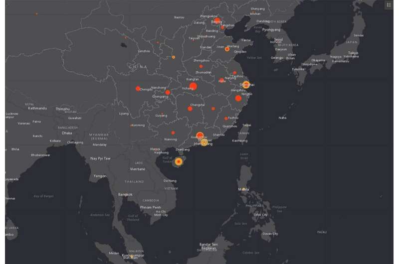
Map tracks coronavirus outbreak in near real time

The Johns Hopkins Center for Systems Science and Engineering has built and is regularly updating an online dashboard for tracking the worldwide spread of the coronavirus outbreak that began in the Chinese city of Wuhan.
Lauren Gardner, a civil engineering professor and CSSE's co-director, spearheaded the effort to launch the mapping website on Wednesday. The site displays statistics about deaths and confirmed cases of coronavirus, or 2019-nCoV, across a worldwide map. It also allows visitors to download the data for free.
"We built this dashboard because we think it is important for the public to have an understanding of the outbreak situation as it unfolds with transparent data sources," Gardner said. "For the research community, this data will become more valuable as we continue to collect it over time."
Making the data available for download is "critical" for researchers, she added.
The statistics behind the data visualization are being collected from the World Health Organization, the Centers for Disease Control and Prevention, the National Health Commission of the People's Republic of China, and Dingxiangyuan, a social networking site for health care professionals that provides real-time information on cases.
Gardner said "local level case data" from Dingxiangyuan, media reports, and the local CDC "can provide more timely assessments of the outbreak, compared to the national level reporting organizations, which take longer to filter up."
The CSSE's Wuhan Coronavirus Global Cases website on Thursday afternoon reported 18 related deaths and 653 confirmed cases—444 in the Chinese province of Hubei, of which Wuhan is the capital city.
The website provides a link to a downloadable Google Sheet that contains information on confirmed and suspected cases in more than 30 Chinese locations as well as for the nations of Japan, Thailand, South Korea, Vietnam, Singapore, Colombia, Brazil, Australia, Mexico, and the United States. One case has been confirmed in Washington state.
The CSSE website does not yet predict where the flu-like virus is likely to spread.
Last year, Gardner and a team of researchers identified 25 U.S. counties that were most likely to experience measles outbreaks in 2019. The predictive analysis, published in The Lancet Infectious Diseases, was based on international air travel volume, non-medical exemptions from childhood vaccinations, population data, and reported measles outbreak information.


